

|
|
||||||
| A site based around our obsession. | |||||||
Fordyce |
These are some of the trails we've taken. All waypoints and Trail Tracks were taken using a Magellan Sport Trak Pro GPS. All 2D and 3D Map shots were used using Magellan Mapsend Topo 3D. Earth shots are used using Google Earth Plus. |
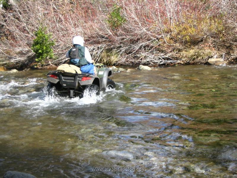
| Fordyce Creek Trail/Signal Peak: The entire Fordyce Creek Trail is in my opinion, harder than the Rubicon. Unfortunately, PG&E controls the water height of the 3 Fordyce river crossings that are required to complete the whole trail. This is usually only possible during the August Sierra Trek 4WD run. However, the first part of this trail, which starts at Eagle Lakes Road exit of I80, is still challenging. This is particularly true if you decide to go down to Fordyce River crossing #1 and complete the Signal Peak run. Add some snow into the picture....and it's downright brutal. |
 |
| As you can see...not only is the Fordyce Creek Trail one of the toughest around, but there is LOTS of riding in this area...as seen by all the yellow. |
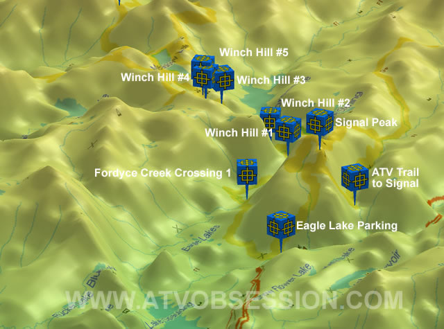 |
| A good overall shot of the entire Fordyce Creek Trail. Definitely one of the toughest around. |
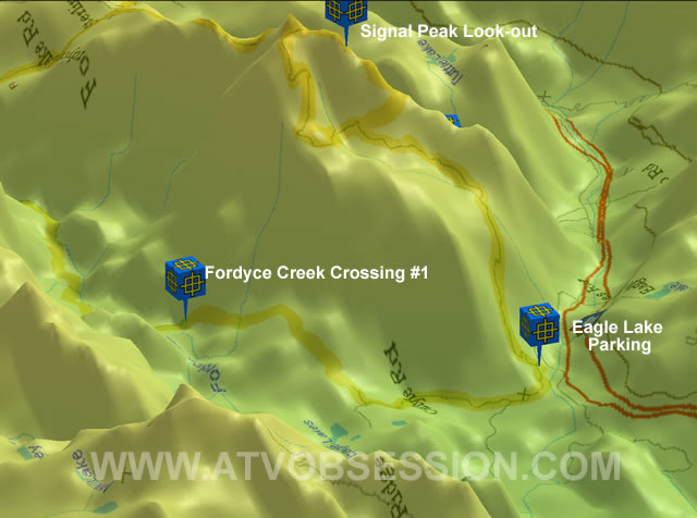 |
| A nice diversion from the trail, is a run up to Signal Peak. Spectacular views. |
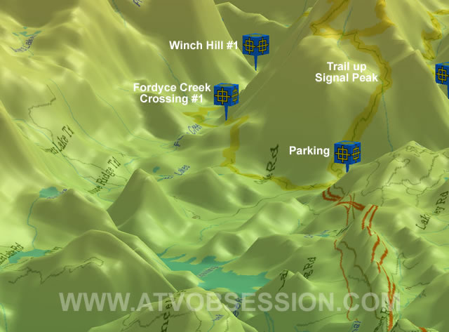 |
| The start of the trail and most commonly travelled area. Parking to Fordyce Creek Crossing #1. |
 |
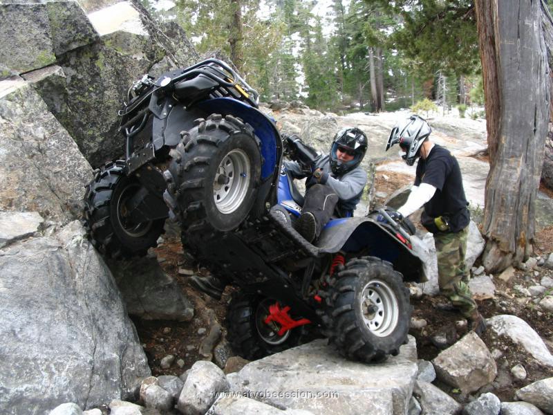
| Coming up from the parking, the first tough spot is the HARDEST part of the trail...Winch Hill #1. |
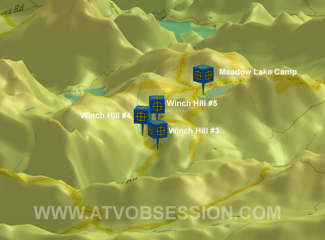 |
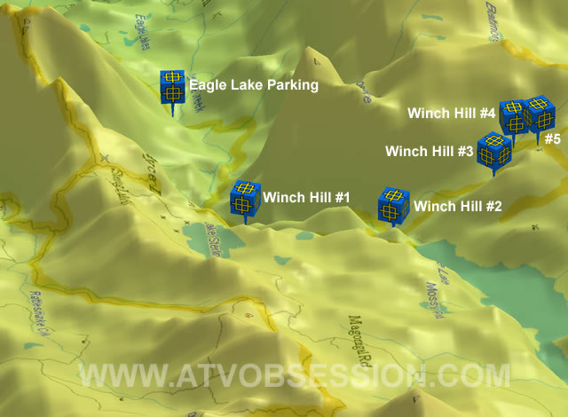
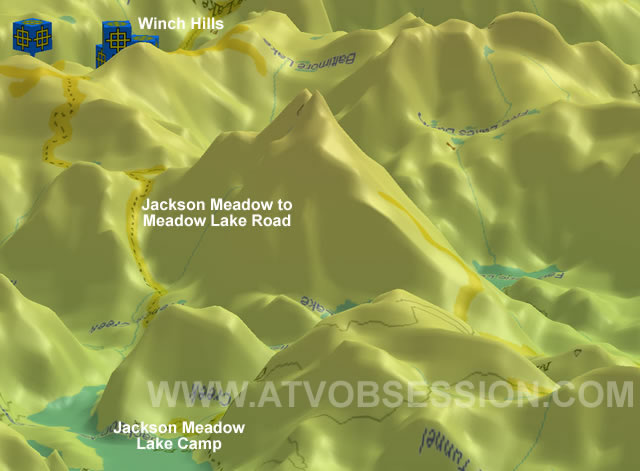
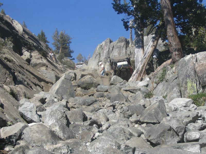
| Winch Hill's #3, 4, 5 come in quick succession. By the time you hit #5, you're done. You want a bath and beer. |
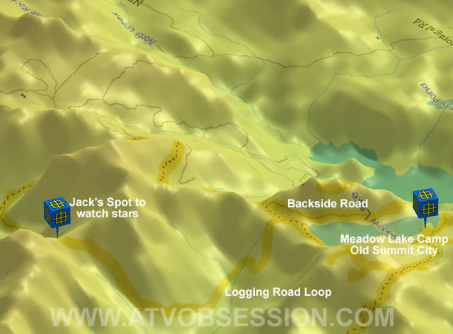 |
| Once in camp, a nice night ride is to hit the logging roads. Stop at Jack's Spot for some star gazing. |
 |
| If you're at the developed sites at Jackson-Meadow Resevoir, take the road over to Meadow Lake. |
| Click Here To Download a sample of my Fordyce Creek/Signal Peak Tracks. |