What GPS would you buy?
Moderator: hemingray
-
Mrbanzai

- Just realized teal ATV clothes are lame
- Posts: 16
- Joined: Fri Mar 24, 2006 7:55 am
- Location: Libby,Montana IE: Montana Jacks
What GPS would you buy?
Being totaly new to the GPS world,, and price not a factor, what GPS brand and model would you buy so that you would have flexibility in the future and not regret the purchase later? thanks in advance!
Ride & Live Polaris MY Way Out!
Earth first, we'll log the other planets later.
If you aint got Jack's, you aint got Jack.
Earth first, we'll log the other planets later.
If you aint got Jack's, you aint got Jack.
-
GrizzlyGuy

- Forever On The trail - RIP
- Posts: 1411
- Joined: Sun Jul 08, 2007 6:11 pm
- Location: Truckee, CA
- Contact:
I have a Garmin 60 CSx and I don't think you could go too wrong with one of those. It has a good receiver and you can load custom trail maps onto it. Waterproof and rugged.
However, I would take a look at the Magellan Triton 400. It may be my next GPS receiver. The reviews are favorable, sounds like you can load custom maps on it as well, is waterproof. It has some unique features like being able to record an audio note to associate with waypoints, a built in 2 MP digital camera, etc. 2 MP wouldn't get you real good pictures, but if you could snap a quick picture to remind you later of what a waypoint you saved looked like... I think that's neat. See here:
http://www.gpsreview.net/magellan-triton-2000/
TV For Thrill Seekers: http://AdventureWorld.TV
More Videos: http://GrizzlyGuy.TV
Some More Videos: http://www.youtube.com/user/ATVGrizzlyGuy
Photos: http://www.GrizzlyGuy.com/ATVs
My quad: Grizzly 700, 25" Bighorns, Bash Plates,
Warn 2500 Winch
More Videos: http://GrizzlyGuy.TV
Some More Videos: http://www.youtube.com/user/ATVGrizzlyGuy
Photos: http://www.GrizzlyGuy.com/ATVs
My quad: Grizzly 700, 25" Bighorns, Bash Plates,
Warn 2500 Winch
-
d2photo

- Is Totally Obsessed
- Posts: 816
- Joined: Mon Apr 03, 2006 10:24 pm
- Location: You can hear the banjos
- Contact:
Well, I went to MacWorld yesterday and went by and visited the nice folks @ Garmin.
They FINALLY have the Mac software out to transfer files and all of the other fun stuff I have had to carry a PC laptop for.
The new software "Bobcat" is a free download from the Gamrin site.
I have the Mapsource Topo maps for the PC and was told, all I would have to do is "convert" the maps using an app provided on their site.
Going to attempt this this weekend - will let you know how I fair.
D2
www.peta-atv.com
'06 650 V2 Cat (roll count - 3) (rides w/o roll - 40
"You may not be the solution, but you can ALWAYS be part of the problem. It's good to contribute where you can"
www.peta-atv.com
'06 650 V2 Cat (roll count - 3) (rides w/o roll - 40
"You may not be the solution, but you can ALWAYS be part of the problem. It's good to contribute where you can"
Yes Griz...that new Triton with the camera and recorder is pretty cool. Kendo and I have been talking about it. At first I was lukewarm to the idea...but when we started thinking of....Waypointing Campsites, etc. And of course, the GeoCachers will go nuts.
The last words spoken before a YouTube video is filmed: "Hold my beer, now watch this..."
Regards,
Ken Hower
RTF Director
http://www.rubicontrail.org/
Regards,
Ken Hower
RTF Director
http://www.rubicontrail.org/
-
GrizzlyGuy
- Forever On The trail - RIP
- Posts: 1411
- Joined: Sun Jul 08, 2007 6:11 pm
- Location: Truckee, CA
- Contact:
Hot dawg! That's great news. Ever since switching to a mac for video editing, it has kind of become my favorite computer and words like "windoze" are starting to enter my vocabulary. So if I can use the mac for my GPS-related tasks, it's all good.d2photo wrote:Well, I went to MacWorld yesterday and went by and visited the nice folks @ Garmin.
They FINALLY have the Mac software out to transfer files and all of the other fun stuff I have had to carry a PC laptop for.
Can't wait to hear how it works out for you.
I mentioned the Magellan Triton above as a sweet-sounding unit, ran over to Amazon to check the price, and found that the reviews over there haven't been so favorable (dohhhh!!):
http://www.amazon.com/Magellan-Triton-2 ... B000V4VGAI
TV For Thrill Seekers: http://AdventureWorld.TV
More Videos: http://GrizzlyGuy.TV
Some More Videos: http://www.youtube.com/user/ATVGrizzlyGuy
Photos: http://www.GrizzlyGuy.com/ATVs
My quad: Grizzly 700, 25" Bighorns, Bash Plates,
Warn 2500 Winch
More Videos: http://GrizzlyGuy.TV
Some More Videos: http://www.youtube.com/user/ATVGrizzlyGuy
Photos: http://www.GrizzlyGuy.com/ATVs
My quad: Grizzly 700, 25" Bighorns, Bash Plates,
Warn 2500 Winch
The triton is nice, I've got a explorist 600 now and it is great, although I really dislike the non-standard cables that Magellan uses. They have this funky looking connector the screws into the back of the unit, then towards the opposite end there is a Y junction. One arm of the Y is another cable that has a USB connector on the end for hooking up to a computer. The other arm is for input where you plug in your power adapters. I'm not sure how the auto kit connects in, but I think the cable itself is a pretty shitty cable, after a while the insulation on the USB cable coming out of the Y junction starts to come out exposing the wires. I guess if you don't coil the cable up, it probably wouldn't happen as fast. Garmin has a new series coming out called the Colorado which I think is a really tight unit.
http://www.gpsmagazine.com/2008/01/garm ... review.php
The T version of the Colorado has topo maps and has a rocker and roller switch which makes it easy to use with gloves on. That is what I dislike about the explorist now is that the buttons are a piece of shit to work with when it is cold and you're wearling gloves. It is a decent unit, and portable, just a real pain with the buttons.
The triton is a nice looking unit, and I love the features of the camera for taking pics of the waypoint, and the touch screen is awesome as well. I think both gps's are great units.
-
GrizzlyGuy
- Forever On The trail - RIP
- Posts: 1411
- Joined: Sun Jul 08, 2007 6:11 pm
- Location: Truckee, CA
- Contact:
It's good news that you all are liking the features of the Triton, now I know I'm not wacky. OK, at least not wacky in this one area.teejay wrote: The triton is a nice looking unit, and I love the features of the camera for taking pics of the waypoint, and the touch screen is awesome as well. I think both gps's are great units.
I read through the Amazon comments again, and it sounds to me like Magellan may just need to issue a firmware update and all those problems would go away. I sure hope so, because they are also kicking Garmin's butt in another area: maps. The triton can apparently use Nat Geo topos, which are quite a bit richer/nicer than the Garmin maps.
For example, here is a relatively drab Garmin map (relative to Nat Geo maps) showing a place out here that lots of folks will recognize:

Problem is... there are all kinds of legal/fun trails not shown on that map.
My solution has been to create a custom trail map to load on top of that one so that I see the trails lying on top of the Garmin map on my 60CSx. Here's what my trail map looks like in that same area:

Sorry I can't show you one picture of the whole thing, you'll have to imagine my trail lines sitting on top of the topo.
Neat, eh? So now look at what the triton is offering: start out with a better base map (the Nat Geo ones), then load your trails on top of that as tracks. You get your cake and can eat it to. So let's hope the Magellan geeks can fix up whatever problems they are having with a firmware update, and that thing should be a suhhhhhweeeeet unit.
TV For Thrill Seekers: http://AdventureWorld.TV
More Videos: http://GrizzlyGuy.TV
Some More Videos: http://www.youtube.com/user/ATVGrizzlyGuy
Photos: http://www.GrizzlyGuy.com/ATVs
My quad: Grizzly 700, 25" Bighorns, Bash Plates,
Warn 2500 Winch
More Videos: http://GrizzlyGuy.TV
Some More Videos: http://www.youtube.com/user/ATVGrizzlyGuy
Photos: http://www.GrizzlyGuy.com/ATVs
My quad: Grizzly 700, 25" Bighorns, Bash Plates,
Warn 2500 Winch

I have read some bad press on the Triton, at least the first batch that was released. Apparently, Magellan wasn't really ready to release and jumped the gun a little. They use National Geographic topo map software and the early ones had a lot of trouble with the interface to load the maps. They delayed shipment for a bit and now I have seen them starting to appear again (saw a 400 in Sportsmans Warehouse this weekend).
For those familiar with NG topo maps, they are the creme' de la creme' of the mapping world. Outstanding detail and very accurate. Albeit at a price though - $99 per state!!! So for the entire US - that's $5000 girls and boys.
The camera and voice recorder are very cool features. Touchscreen seems to be the wave of the future as well. I can see that going either way on the trial, either a benefit or detriment.
I just bought an Explorist XL, mainly due to the larger screen. Maps are good too, maybe not NG standard, but pretty decent. During my search, I discovered DeLorme units. Again, excellent mapping software, and their new Earthmate (I think) units, you can combine aerial maps with your topo software and I believe even overlay on the screen. You can do 3D fly overs as well. Very cool! However, the unit I saw at SW had a very small screen, maybe 2" at the most. So that could be extremely difficult to navigate by on the quad. Hiking, sure, no problem. Moving at mach 3 and having to negotiate the next turn, uhm, probably not.
The other cool thing DeLorme has is a GPS 'fob' of sorts that connects via USB to your laptop. It is basically an antenna which you place in clear view of the sky thereby turning your PC into a big GPS with screen to match. Handy for the camping crew that wants to plan the next days ride and doesn't necessarily want to do it with a 3.5" screen and slow scrolling. It's reasonable too, the whole package is $149 and that includes the 'fob' and the topo map software.
I think in the next couple of years, we're going to see a whole new generation of GPS units and the aerial stuff will be commonplace. I wouldn't put it past Google to jump in the game, partnered up with ???? to offer a unit that is preloaded with Google Earth. I'd like to see that in a larger Nuvi or Maestro format. Something that truly is a 'universal GPS' for both street and trail. I'd buy one - no doubt.
For those familiar with NG topo maps, they are the creme' de la creme' of the mapping world. Outstanding detail and very accurate. Albeit at a price though - $99 per state!!! So for the entire US - that's $5000 girls and boys.
The camera and voice recorder are very cool features. Touchscreen seems to be the wave of the future as well. I can see that going either way on the trial, either a benefit or detriment.
I just bought an Explorist XL, mainly due to the larger screen. Maps are good too, maybe not NG standard, but pretty decent. During my search, I discovered DeLorme units. Again, excellent mapping software, and their new Earthmate (I think) units, you can combine aerial maps with your topo software and I believe even overlay on the screen. You can do 3D fly overs as well. Very cool!
The other cool thing DeLorme has is a GPS 'fob' of sorts that connects via USB to your laptop. It is basically an antenna which you place in clear view of the sky thereby turning your PC into a big GPS with screen to match. Handy for the camping crew that wants to plan the next days ride and doesn't necessarily want to do it with a 3.5" screen and slow scrolling. It's reasonable too, the whole package is $149 and that includes the 'fob' and the topo map software.
I think in the next couple of years, we're going to see a whole new generation of GPS units and the aerial stuff will be commonplace. I wouldn't put it past Google to jump in the game, partnered up with ???? to offer a unit that is preloaded with Google Earth. I'd like to see that in a larger Nuvi or Maestro format. Something that truly is a 'universal GPS' for both street and trail. I'd buy one - no doubt.
'15 Can Am Maverick XRS DPS
So do we need a jury?Kendo wrote:I can see that going either way on the trial
The last words spoken before a YouTube video is filmed: "Hold my beer, now watch this..."
Regards,
Ken Hower
RTF Director
http://www.rubicontrail.org/
Regards,
Ken Hower
RTF Director
http://www.rubicontrail.org/
-
d2photo
- Is Totally Obsessed
- Posts: 816
- Joined: Mon Apr 03, 2006 10:24 pm
- Location: You can hear the banjos
- Contact:
Well theres this little doohicky now from Garmin as well - Its called the colorado -

It also has a 3-d display on the unit - because you didn't know you were in a canyon - it has to show ya.

It also has a 3-d display on the unit - because you didn't know you were in a canyon - it has to show ya.
D2
www.peta-atv.com
'06 650 V2 Cat (roll count - 3) (rides w/o roll - 40
"You may not be the solution, but you can ALWAYS be part of the problem. It's good to contribute where you can"
www.peta-atv.com
'06 650 V2 Cat (roll count - 3) (rides w/o roll - 40
"You may not be the solution, but you can ALWAYS be part of the problem. It's good to contribute where you can"
-
GrizzlyGuy
- Forever On The trail - RIP
- Posts: 1411
- Joined: Sun Jul 08, 2007 6:11 pm
- Location: Truckee, CA
- Contact:
The plot thickens.d2photo wrote:Well theres this little doohicky now from Garmin as well - Its called the colorado -
Do you know if Garmin is sticking to their 1000-waypoints-is-enough-for-everyone stance in this new model? Because if they are, I might go grab one of my old Garmies, put a couple .30 caliber holes in it, and mail it to Garmin HQ with this note:
Dear fellow geeks,
NO, 1000 waypoints IS NOT enough for everyone. I rode out of my expected area, and a few more waypoints might have prevented what I did to this poor ole Garmy in frustration when I got lost.
TV For Thrill Seekers: http://AdventureWorld.TV
More Videos: http://GrizzlyGuy.TV
Some More Videos: http://www.youtube.com/user/ATVGrizzlyGuy
Photos: http://www.GrizzlyGuy.com/ATVs
My quad: Grizzly 700, 25" Bighorns, Bash Plates,
Warn 2500 Winch
More Videos: http://GrizzlyGuy.TV
Some More Videos: http://www.youtube.com/user/ATVGrizzlyGuy
Photos: http://www.GrizzlyGuy.com/ATVs
My quad: Grizzly 700, 25" Bighorns, Bash Plates,
Warn 2500 Winch
ROFL...
The last words spoken before a YouTube video is filmed: "Hold my beer, now watch this..."
Regards,
Ken Hower
RTF Director
http://www.rubicontrail.org/
Regards,
Ken Hower
RTF Director
http://www.rubicontrail.org/
-
GrizzlyGuy
- Forever On The trail - RIP
- Posts: 1411
- Joined: Sun Jul 08, 2007 6:11 pm
- Location: Truckee, CA
- Contact:
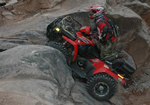
Or maybe it would get through to the Garmin geeks a little better if I also enclosed this picture and said THESE GUYS shot the holes in my Garmy after I got lost. And my Grizzly is full of holes too, thank you very fawking much!

TV For Thrill Seekers: http://AdventureWorld.TV
More Videos: http://GrizzlyGuy.TV
Some More Videos: http://www.youtube.com/user/ATVGrizzlyGuy
Photos: http://www.GrizzlyGuy.com/ATVs
My quad: Grizzly 700, 25" Bighorns, Bash Plates,
Warn 2500 Winch
More Videos: http://GrizzlyGuy.TV
Some More Videos: http://www.youtube.com/user/ATVGrizzlyGuy
Photos: http://www.GrizzlyGuy.com/ATVs
My quad: Grizzly 700, 25" Bighorns, Bash Plates,
Warn 2500 Winch
Who is online
Users browsing this forum: No registered users and 40 guests