Paiute Trail (North/West portion)

Now post your ride photos

Moderator: hemingray

User avatar
BruteForce
Knows UPS driver on a 1st name basis
Posts: 312
Joined: Fri Sep 28, 2007 8:21 pm
Location: South Jordan, Utah

Paiute Trail (North/West portion)

Postby BruteForce » Sun Oct 18, 2009 8:54 am

I took last Friday off to get in one last Paiute ride before the snow falls. The weather could not have been better.

I staged at the 01 trail near the Fremont Indian Museum.

From there, I rode the 01 to all the way North to the Sand Rock Ridge area (03 trail)., following the 03 into Fillmore.

I went to the Maverick at the south end of town for a quick fuel refill and some food.

From there, I wheeled all the way South into Kanosh and went up the 06 past Adelaide campground. From there, I took the 97 trail, connected back to the 01 and from the 01 to the 10 into Joseph.

From the I70 into Joseph, I found a side trail that paralleled I-70 all the way until I connected to the 76.

I followed the 76 back to the lower Max Reid Gate and back on the 01 to FISP.

What a great ride! I totaled about 120 miles that day!
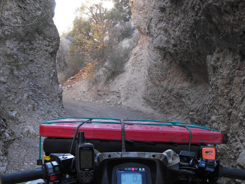
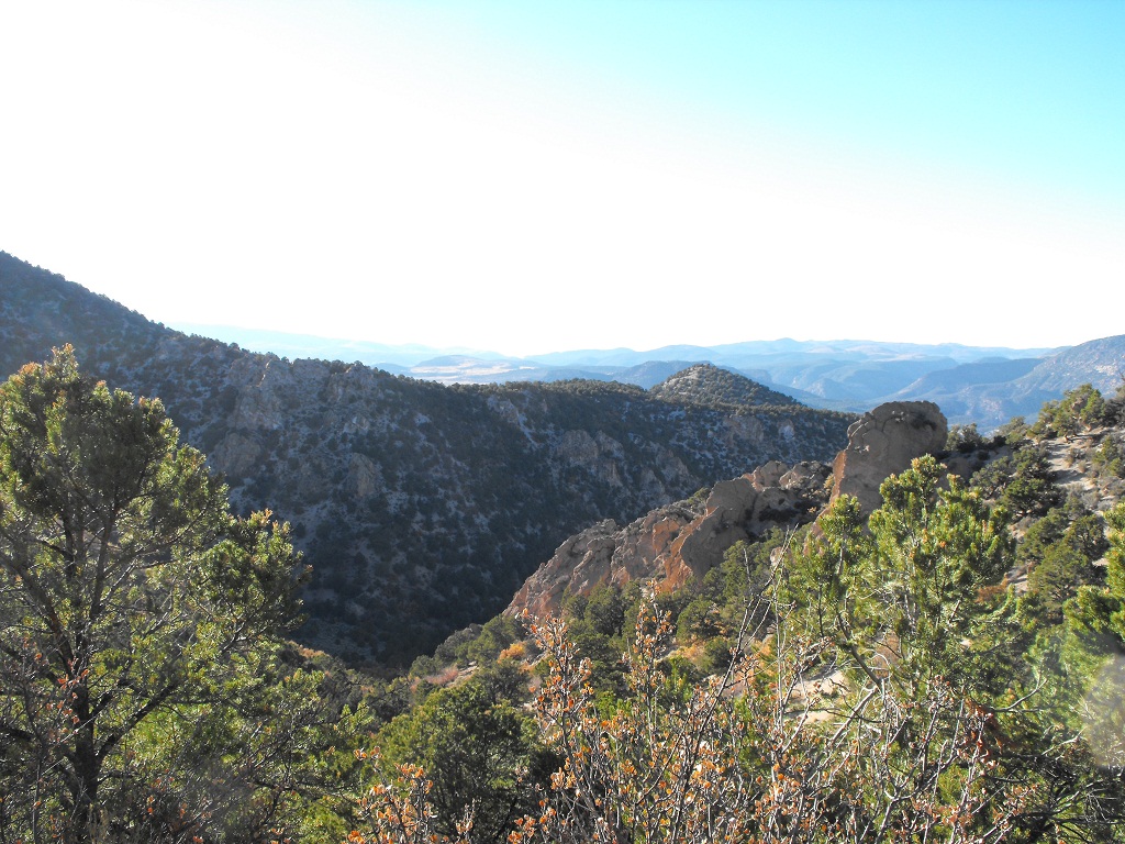
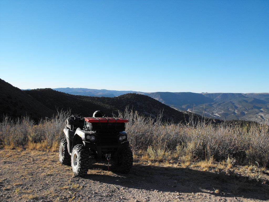
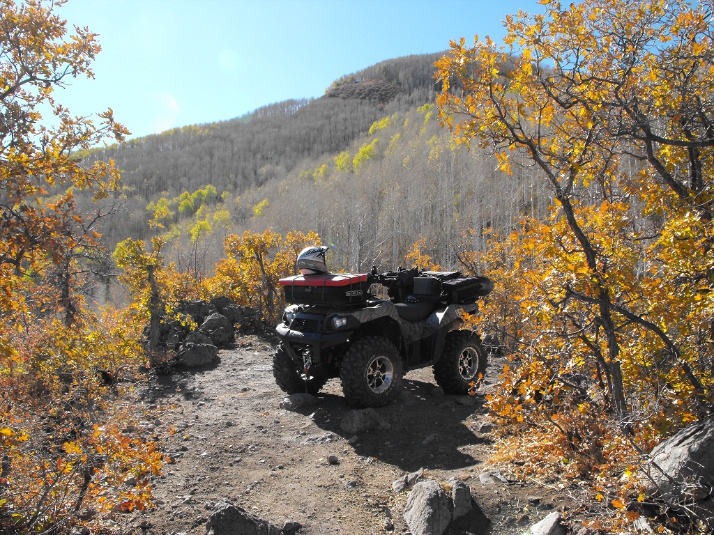
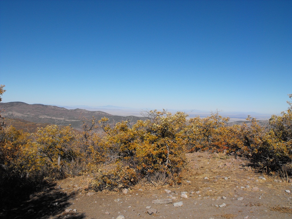
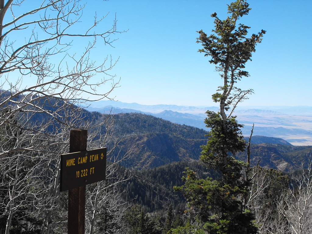
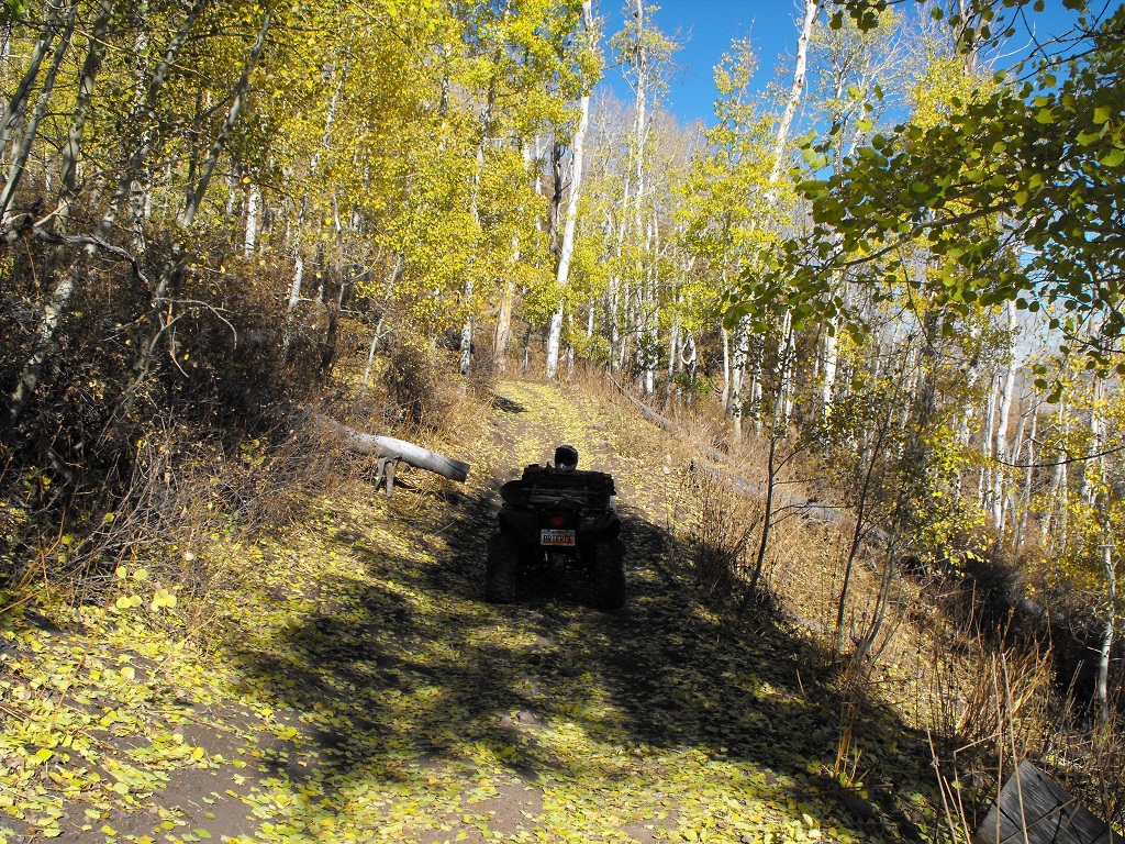
A few photos:

Image
Image
Image
Image
Image
Image
Image
2013 Sportsman XP 850 (Browning Edition) FI/EPS/LE
2005 & 2008 Kawasaki Brute Force 750i

Rider has ferocious attitude!

My blog site: http://utahbruteforce.com

User avatar
hemingray
Certified: OBSESSED
Posts: 1898
Joined: Mon Mar 12, 2007 2:24 pm
Location: Auburn, CA

Postby hemingray » Sun Oct 18, 2009 10:07 am

Nice! I'm with you - ride 'til you can't. The days are shorter, but the scenery sure is nice. I'm envious of how you have so many trails - it's nearly impossible in the Tahoe to make a decent loop. Everything is out and back and every stub road counts for some mileage! :-)

Thanks for the pix!
Wherever I go, there I am

Paynes Creek 2016!

~~~~~~~~~~~~~~~~~~
16 Yamaha Wolverine R-Spec EPS SE
09 Yamaha Grizzly 700 FI 4x4 EPS

User avatar
GrizzlyGuy
Forever On The trail - RIP
Posts: 1411
Joined: Sun Jul 08, 2007 6:11 pm
Location: Truckee, CA
Contact:

Re: Paiute Trail (North/West portion)

Postby GrizzlyGuy » Mon Oct 19, 2009 8:04 am

You have too much fun out there, BruteForce! Beautiful pictures. I've been on all the trails you mentioned except for this one:
BruteForce wrote:From the I70 into Joseph, I found a side trail that paralleled I-70 all the way until I connected to the 76.
The Paiute trail map doesn't show that side trail, Joseph is supposed to be a dead end so we've never ridden down to it. If you happen to have a track log showing that side trail, I'd love to have it for my collection. :-)
TV For Thrill Seekers: http://AdventureWorld.TV
More Videos: http://GrizzlyGuy.TV
Some More Videos: http://www.youtube.com/user/ATVGrizzlyGuy
Photos: http://www.GrizzlyGuy.com/ATVs
My quad: Grizzly 700, 25" Bighorns, Bash Plates,
Warn 2500 Winch

User avatar
BruteForce
Knows UPS driver on a 1st name basis
Posts: 312
Joined: Fri Sep 28, 2007 8:21 pm
Location: South Jordan, Utah

Re: Paiute Trail (North/West portion)

Postby BruteForce » Mon Oct 19, 2009 8:22 am

GrizzlyGuy wrote:You have too much fun out there, BruteForce! Beautiful pictures. I've been on all the trails you mentioned except for this one:
BruteForce wrote:From the I70 into Joseph, I found a side trail that paralleled I-70 all the way until I connected to the 76.
The Paiute trail map doesn't show that side trail, Joseph is supposed to be a dead end so we've never ridden down to it. If you happen to have a track log showing that side trail, I'd love to have it for my collection. :-)
Correct, it's not on the map. It's not labeled either - until you come out the other side on Clear Creek Road (pavement). At first, I was certain I was on an illegal local-created trail, until I saw the sign at the end.

The trail starts at the fence just before you go under the freeway bridge (on your right as you're about to go under the freeway). From there, you can connect to the 76 trail (go right to drive on pavement or go left and enjoy that awesome 76 trail).

Edited to add: Trail is roughly at this location: N 38° 37.520 W 112° 13.760. View this in Google Earth and you'll see it. I'm still convinced this trail isn't quite legit - as it followed the I70 fence and was pretty gnarly. Ride at your own risk/peril.
2013 Sportsman XP 850 (Browning Edition) FI/EPS/LE
2005 & 2008 Kawasaki Brute Force 750i

Rider has ferocious attitude!

My blog site: http://utahbruteforce.com

User avatar
EigerMike
Certified: OBSESSED
Posts: 1800
Joined: Wed Apr 23, 2008 5:05 pm
Location: Orland ca

Postby EigerMike » Wed Oct 21, 2009 3:07 pm

great pics!thanks for sharing :D
South Side Keeper

Paynes Creek 2017


Who is online

Users browsing this forum: No registered users and 70 guests