Page 1 of 1
Skyline Drive (Wasatch Front, Salt Lake City Utah)
Posted: Sun Jul 20, 2008 4:38 pm
by BruteForce
Well, the weather was perfect for a bit of riding today (temps at 9000 feet were in the mid 60's, while the valley below was high 90's).
Started off behind the "B" in Bountiful, travelled all the way to the East of Kaysville, almost to Morgan and as far South/East as behind the State Capitol.
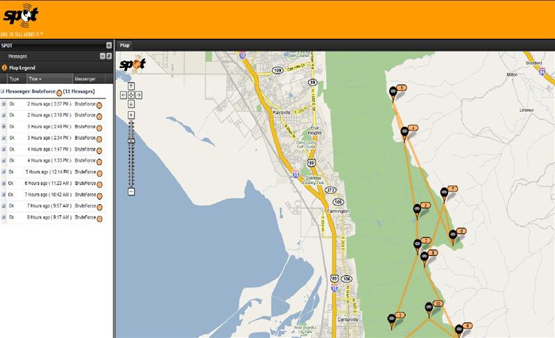
First, the SPOT track page:
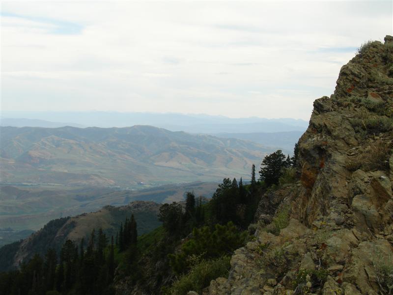
Mid Skyline Drive
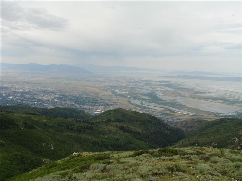
Looking West toward Antelope Island
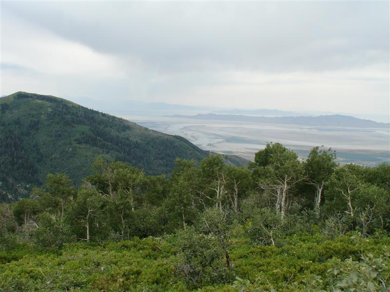
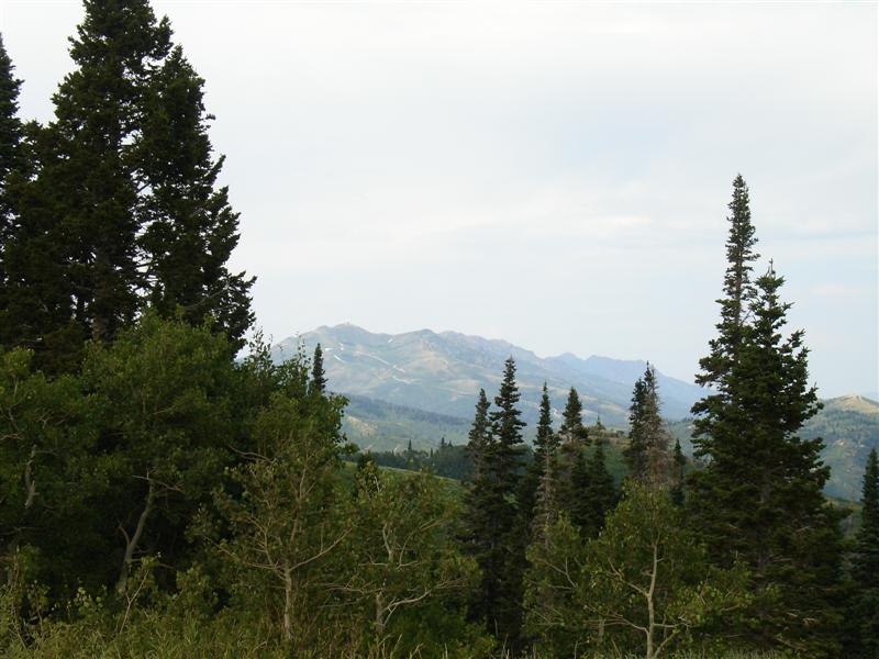
Looking North/East
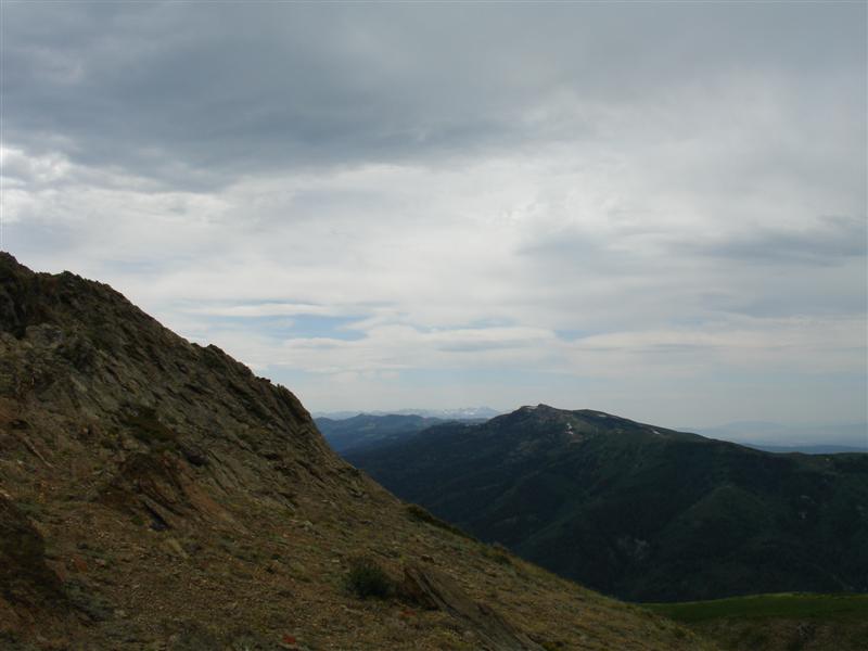
Looking South/East (toward Morgan)
The FAA Radar Station

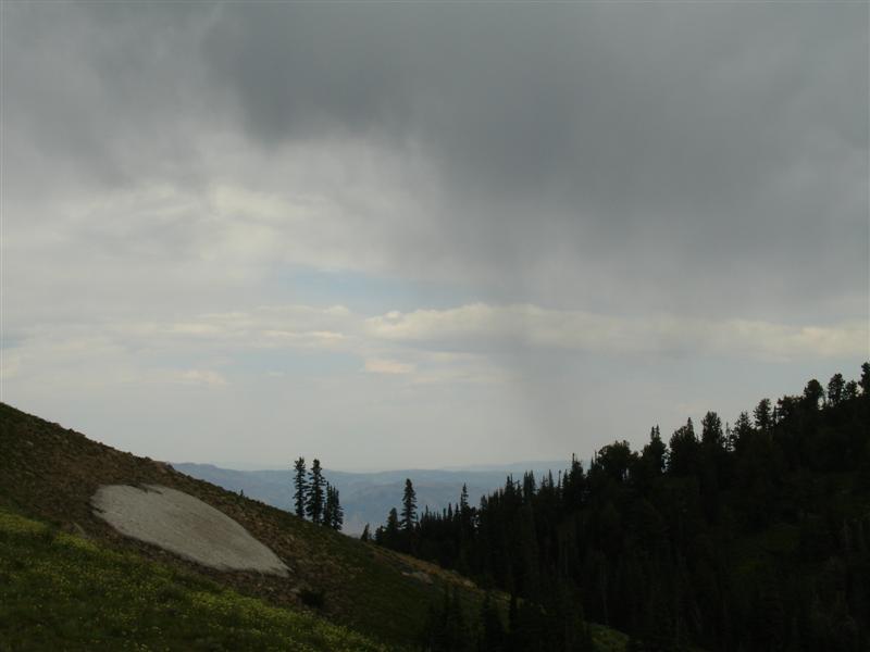
A bit of weather coming in (grey and rainy)
Looking at the radar from ~40 miles South
Posted: Sun Jul 20, 2008 5:02 pm
by EigerMike
nice looking country and good pics. how many miles?
Posted: Sun Jul 20, 2008 5:36 pm
by BruteForce
I believe I clocked 85 miles round trip.
I got upwards of 9800 feet elevation.
Posted: Sun Jul 20, 2008 7:54 pm
by EigerMike
thanks for the pics allways nice seeing new country!
Posted: Sun Jul 20, 2008 7:55 pm
by GrizzlyGuy
That's neat that there is so much riding near a major city. You'd be hard pressed to find an ATV trail within 50 miles of San Francisco.
Posted: Sun Jul 20, 2008 9:05 pm
by hemingray
Nice! And you answered my question - if one could get up to that radar site (or near it). I was pondering that when we visited SLC last fall.
Dave
Posted: Mon Jul 21, 2008 4:25 am
by BruteForce
GG: That's just one of the nice things about Utah. Within a few miles of the metro Salt Lake City area, a person can ride, hike, peak-bag or go rappelling without too much fuel.
Hemingray: Yes, Skyline Drive runs along the top of the ridge, up to and past the radar station, then it drops down the east (opposite) side into the forest.
Posted: Mon Jul 21, 2008 8:01 am
by dirtbikejohn
nice pics!!!!
my boy is headed to nephi utah in the morning, his 12 yr old allstar baseball team won the nevada state cal ripkin championship.he should be there a week. im hoping to pop in and suprise him mid week but not sure if i can get the time off. great country there in utah. just like here in reno 15 minutes and your on a trail that seems to never end.
anyhow nice pics!!!!
John
Posted: Mon Jul 21, 2008 8:25 am
by BruteForce
dirtbikejohn wrote:nice pics!!!!
my boy is headed to nephi utah in the morning, his 12 yr old allstar baseball team won the nevada state cal ripkin championship.he should be there a week. im hoping to pop in and suprise him mid week but not sure if i can get the time off. great country there in utah. just like here in reno 15 minutes and your on a trail that seems to never end.
anyhow nice pics!!!!
John
Nephi? Not much there, but great ATV trails on the mountains to the East, and just a bit further south is Fillmore and Richfield and the Paiute ATV trail system.
Posted: Mon Jul 21, 2008 8:34 am
by teejay
How did you get over to behind the capitol? I was under the impression that when you get on top of the ridge where you cut over to bountiful peak that road going south crossed into a watershed that is gated?
http://local.google.com/?ie=UTF8&ll=40. ... 4&t=h&z=15
is the turn off I'm thinking about. I'm going to ride skyline on Thursday since it is a state holiday. Do you have any gps track logs that I can load up in topo or google earth to see the route you took?
Posted: Mon Jul 21, 2008 8:41 am
by dirtbikejohn
BruteForce wrote:dirtbikejohn wrote:nice pics!!!!
my boy is headed to nephi utah in the morning, his 12 yr old allstar baseball team won the nevada state cal ripkin championship.he should be there a week. im hoping to pop in and suprise him mid week but not sure if i can get the time off. great country there in utah. just like here in reno 15 minutes and your on a trail that seems to never end.
anyhow nice pics!!!!
John
Nephi? Not much there, but great ATV trails on the mountains to the East, and just a bit further south is Fillmore and Richfield and the Paiute ATV trail system.
i guess they have baseball fields cause thats where the tournaments being held, i heard its only got a pop. of 4000 people. i was hoping that maybe i could bring the quads with me. if they didnt make it all of the way in the terny than we could get a couple of days of quading in ....... well we will see im going to talk to my boss today.
Posted: Mon Jul 21, 2008 9:55 am
by BruteForce
teejay wrote:How did you get over to behind the capitol? I was under the impression that when you get on top of the ridge where you cut over to bountiful peak that road going south crossed into a watershed that is gated?
http://local.google.com/?ie=UTF8&ll=40. ... 4&t=h&z=15
is the turn off I'm thinking about. I'm going to ride skyline on Thursday since it is a state holiday. Do you have any gps track logs that I can load up in topo or google earth to see the route you took?
If you head South past the Farmington campground area, it proceeds to take you almost behind the capitol. Most of the trails are marked (USFS), but I believe the trail I was on may have been out-of-bounds as I stopped seeing signage, although the trail looked fairly worn-in.
Here's GPS coords for a trail that plows in a ridge line behind the capitol (I have a geocache there):
N 40° 53.559 W 111° 47.444