Page 1 of 1
Quiz for the day
Posted: Fri Jun 06, 2008 9:39 pm
by hemingray
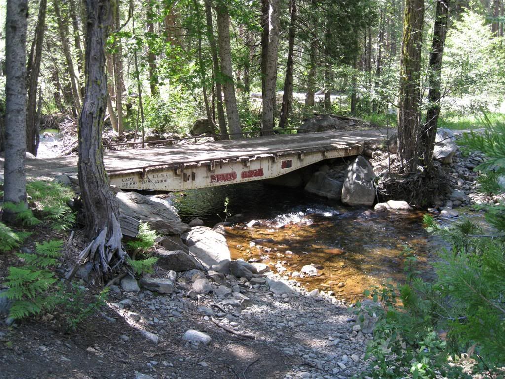
Rode to here today - anyone want to guess where it is? (my unload point was within sight of I-80)
PS - I crossed to the right, of course!
Dave
Posted: Sat Jun 07, 2008 8:04 am
by Ken
don't recognize it.
Posted: Sat Jun 07, 2008 2:15 pm
by auendave
looks like old railroad car to me
Posted: Sat Jun 07, 2008 4:53 pm
by hellcat650
I give.
Posted: Sun Jun 08, 2008 10:51 am
by hemingray
The bridge is an old Southern Pacific Maintenance of Way (SPMW) short flat car. The info on one end says it was last serviced in 1983.
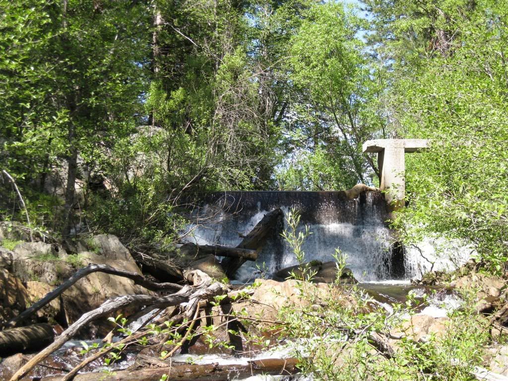
The location is on the Bear River at the west end of the Bear Valley. It's right at the spot where the Boardman Canal once began - just upstream is the old diversion dam. The canal, which runs to Roseville, now begins near Alta.
I parked at Drum Forebay (east end) and there are a bunch of roads and powerline trails (some along the canals - watch for gates!) that lead out from there. Nothing great, but saved a few bucks in gas by not going further east.
Drum Forebay parking spot:
39°15'7.78"N
120°44'47.40"W
Bear River crossing:
39°18'1.54"N
120°41'55.60"W
Here's the old Boardman Canal diversion structure:
Posted: Thu Jun 19, 2008 5:03 pm
by trainman
Wow, an old flat car for a bridge. You guys are really lucky to have rides like that. Excellent pictures.
Posted: Thu Jun 19, 2008 5:14 pm
by EigerMike
great pics looks like a beautifull rideing area.