Shasta Rock Rollers trip photos

Go ahead...Let it out.

Moderator: hemingray

User avatar
traildad
Knows UPS driver on a 1st name basis
Posts: 271
Joined: Wed Jan 04, 2006 9:13 pm
Location: Northern California

Shasta Rock Rollers trip photos

Postby traildad » Sun Jun 24, 2007 11:28 pm

Well I just got back from the annual Shasta Rock Rollers Summer Picnic. We all had a great time and Alex won the last prize on the Poker run. Lots of different kinds of riding up there. We all camp at the old Wildwood mill site on Highway 36 west of Highway 5. Here are some photos.

Image

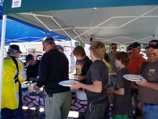
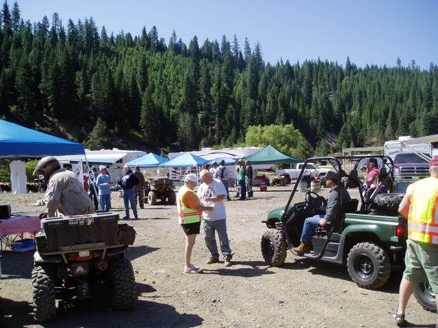
Lunch after the Poker run.
Image

Image

Image

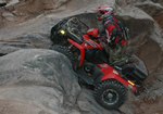
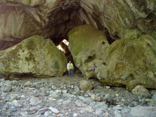
This is a great spot. A Natural Bridge.
Image

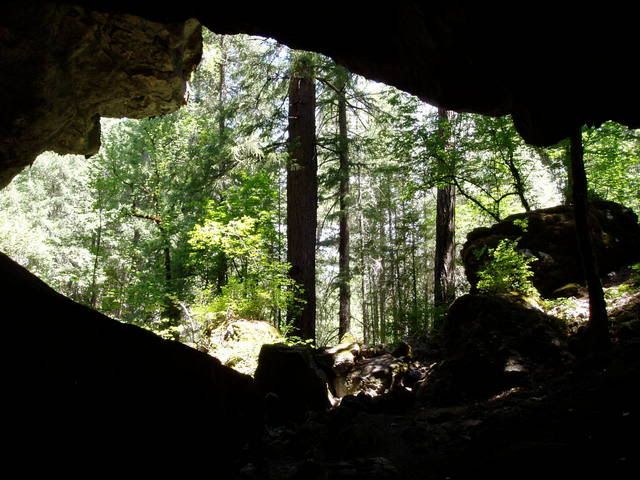
From the inside looking out.
Image

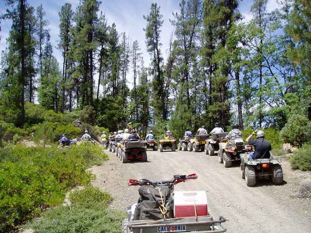
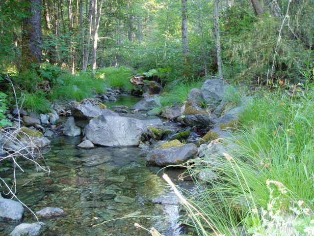
This is a very scenic ride on 13 Dips Road.
Image

Image

Image

Image
05 Yamaha Kodiak 450, Mine
05 Yamaha Kodiak 450, Wife's
We love to go Trail Riding and "ATV Backpacking"

User avatar
Ken
Site Admin
Posts: 7501
Joined: Wed Jan 07, 2004 4:23 pm
Location: Auburn, CA
Contact:

Postby Ken » Mon Jun 25, 2007 6:57 am

Cool...never ridden around there....you'll have to post how to get there in the Trails section.
The last words spoken before a YouTube video is filmed: "Hold my beer, now watch this..."

Regards,
Ken Hower
RTF Director
http://www.rubicontrail.org/

Quadgoddess
Is Totally Obsessed
Posts: 582
Joined: Mon Nov 08, 2004 11:46 am
Location: Camano Island Washington
Contact:

Postby Quadgoddess » Mon Jun 25, 2007 4:18 pm

Nice pics!...very scenic...this one would make a nice 'Bob Ross' painting...:wink:

Image
[url=http://carolann63.smugmug.com/]~My Pix~[/url]

ontherks
Is tracking a shipment right now
Posts: 246
Joined: Sun Oct 16, 2005 7:53 pm
Location: Rancho Cordova
Contact:

Postby ontherks » Mon Jun 25, 2007 7:28 pm

Lol Ive been there, my mom lives pretty close to there. Thats the county I grew up in. But I was more north above trinty lake, not on the south end with all the white trash meth heads.
'14 XP4 1k

User avatar
traildad
Knows UPS driver on a 1st name basis
Posts: 271
Joined: Wed Jan 04, 2006 9:13 pm
Location: Northern California

Postby traildad » Mon Jun 25, 2007 9:35 pm

Ken wrote:Cool...never ridden around there....you'll have to post how to get there in the Trails section.
Is is best to just describe it or is it possible for me to post a GPS track?
05 Yamaha Kodiak 450, Mine
05 Yamaha Kodiak 450, Wife's
We love to go Trail Riding and "ATV Backpacking"

User avatar
Ken
Site Admin
Posts: 7501
Joined: Wed Jan 07, 2004 4:23 pm
Location: Auburn, CA
Contact:

Postby Ken » Mon Jun 25, 2007 10:05 pm

Both if you can....

Just give directions how to get there....what to expect..etc.
The last words spoken before a YouTube video is filmed: "Hold my beer, now watch this..."

Regards,
Ken Hower
RTF Director
http://www.rubicontrail.org/

User avatar
traildad
Knows UPS driver on a 1st name basis
Posts: 271
Joined: Wed Jan 04, 2006 9:13 pm
Location: Northern California

Postby traildad » Mon Jun 25, 2007 10:54 pm

Ken wrote:Both if you can....

Just give directions how to get there....what to expect..etc.
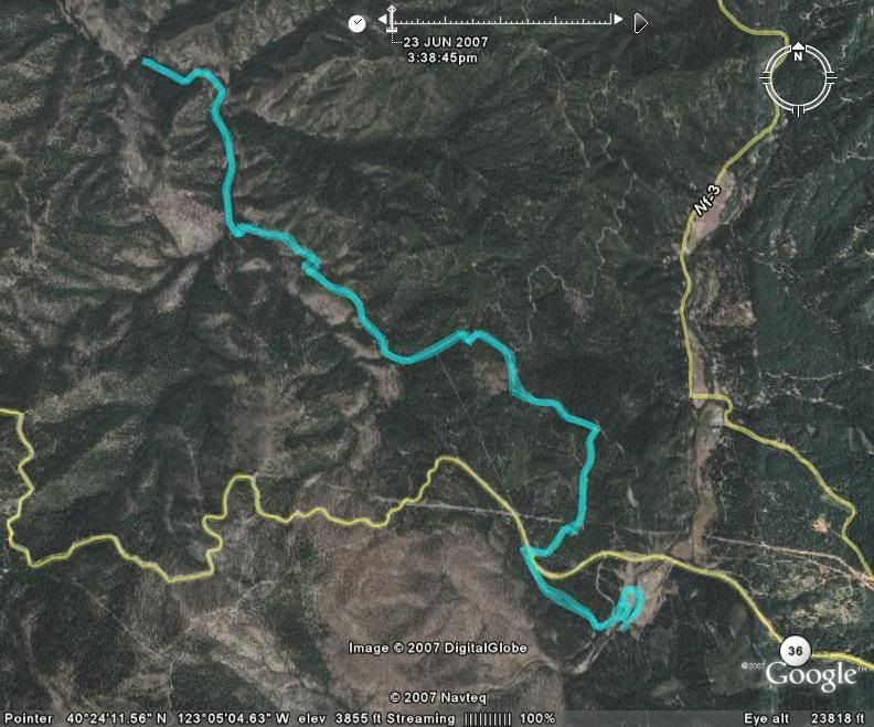
I have Magellan GPS tracks. I am not sure how to go about "uploading" them or how to make them available thru the forum.
05 Yamaha Kodiak 450, Mine
05 Yamaha Kodiak 450, Wife's
We love to go Trail Riding and "ATV Backpacking"

User avatar
Ken
Site Admin
Posts: 7501
Joined: Wed Jan 07, 2004 4:23 pm
Location: Auburn, CA
Contact:

Postby Ken » Tue Jun 26, 2007 5:15 am

Just post the long/Lat numbers of the start and end. If you have tracks, you can convert them to GPX files using GPSbabel and upload them to Google Earth, then do a screenshot from Google....and then post that photo. Google Earth has a File, Save Screen or something like that.
The last words spoken before a YouTube video is filmed: "Hold my beer, now watch this..."

Regards,
Ken Hower
RTF Director
http://www.rubicontrail.org/

User avatar
Kendo
Is Totally Obsessed
Posts: 939
Joined: Wed Apr 18, 2007 9:26 am
Location: Rocklin, CA

Postby Kendo » Tue Jun 26, 2007 12:57 pm

Ken wrote:Just post the long/Lat numbers of the start and end. If you have tracks, you can convert them to GPX files using GPSbabel and upload them to Google Earth, then do a screenshot from Google....and then post that photo. Google Earth has a File, Save Screen or something like that.
Geek. :lol:
'15 Can Am Maverick XRS DPS

User avatar
Ken
Site Admin
Posts: 7501
Joined: Wed Jan 07, 2004 4:23 pm
Location: Auburn, CA
Contact:

Postby Ken » Tue Jun 26, 2007 2:44 pm

Hey..I resemble that remark...
The last words spoken before a YouTube video is filmed: "Hold my beer, now watch this..."

Regards,
Ken Hower
RTF Director
http://www.rubicontrail.org/

User avatar
traildad
Knows UPS driver on a 1st name basis
Posts: 271
Joined: Wed Jan 04, 2006 9:13 pm
Location: Northern California

Postby traildad » Tue Jun 26, 2007 8:02 pm

Lesek ritsuri-wuh-set'ko afersu. :P
05 Yamaha Kodiak 450, Mine
05 Yamaha Kodiak 450, Wife's
We love to go Trail Riding and "ATV Backpacking"

User avatar
traildad
Knows UPS driver on a 1st name basis
Posts: 271
Joined: Wed Jan 04, 2006 9:13 pm
Location: Northern California

Postby traildad » Tue Jun 26, 2007 10:16 pm

Well here is a try. I was checking out Google Earth and I was wondering if it is possible to save the track to the Google community in a way that would allow us to do more than look at a photo. This is the 13 Dips run that I made. The road continues on till it reaches pavement at Highway 3.

Well if this works which it seems like it does the link below will download a Mapsend Topo 3D track of the 13 Dips run. This might be a way to distribute the track to members of the forum. 8)


http://us.f13.yahoofs.com/bc/43e02bbdm9 ... GB6NrE5_Mi

Image
05 Yamaha Kodiak 450, Mine
05 Yamaha Kodiak 450, Wife's
We love to go Trail Riding and "ATV Backpacking"

User avatar
Ken
Site Admin
Posts: 7501
Joined: Wed Jan 07, 2004 4:23 pm
Location: Auburn, CA
Contact:

Postby Ken » Wed Jun 27, 2007 6:53 am

You can definitely share.

The best way...create a folder or main menu(I forget what they call it). Then inside that folder, say it's SHASTA, put your track inside. Then perhaps zoom the camera around, and do some placemarks. Also save those inside Shasta.

Once done, right click on SHASTA and Save as KMZ...name it Shasta. I can add the file to the site, and add it to the trails.


Here's one that I did for Dusy-Ershim.

viewtopic.php?t=1183
The last words spoken before a YouTube video is filmed: "Hold my beer, now watch this..."

Regards,
Ken Hower
RTF Director
http://www.rubicontrail.org/


Who is online

Users browsing this forum: No registered users and 120 guests